
The US Global Positioning System or GPS is omnipresent and omniscient. In a bid to gain “strategic independence,” India is now ditching this US-owned satellite-based navigation system in favor of its own NavIC (meaning ‘sailor’ in Hindi) navigation system.
Awaiting 4.5-Gen Rafale Fighters, Indonesia Buys 12 Second-Hand Mirage 2000-5 Jets From Qatar; Here Is Why
Stifled By ‘Authoritarian’ China & N.Korea, South Korea’s National Security Strategy Calls For ‘Unbreakable’ Ties With US, Japan
So far, the lack of compatibility of mobile handsets with the system has deterred its availability to the masses, but this is about to change.
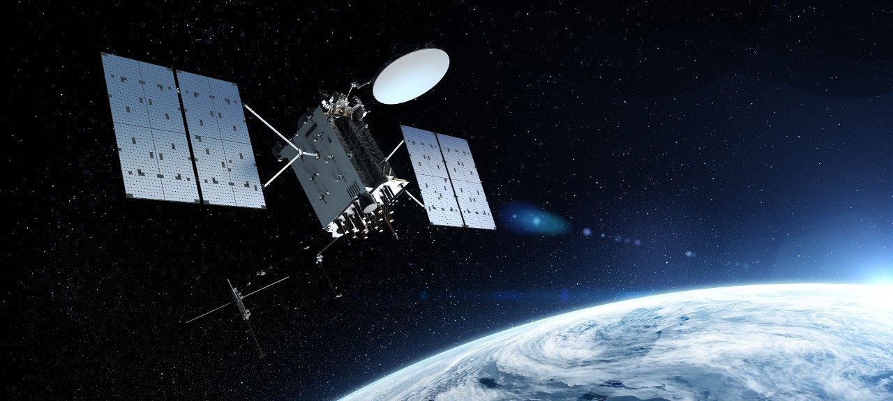
India has successfully placed its second-generation navigation satellite in orbit, and this could help in bridging the gap between the technology and Indian mobile users.
The satellite is the first in a series of five. Now every six months, India will launch one satellite to complete the coverage. The NVS-01 carried navigation payloads of L1, L5, and S bands. “NVS-01 is the first of the second-generation satellites envisaged for the Navigation with Indian Constellation (NavIC) services.
NVS series of satellites will sustain and augment the NavIC with enhanced features. This series incorporates L1 band signals additionally to widen the services,” the Indian Space Research and Organisation (ISRO) said in a statement after the launch.
The new Indian satellite incorporating the L1 band signal means the phone makers would not require hardware changes in the handsets to make NavIC available to consumers.
Its interoperability means it can be used across mobile through software updates. L1 is compatible with the handsets and can be made available through a mobile app, just like GPS.
The original L5 and S frequencies of NavIC were not civilian-use frequencies. The phone makers like Apple, Samsung, and Xiaomi had to put in additional chipsets and hardware to make their devices NavIC-compatible. This would have made the devices costlier. This hindered the widespread adoption of the technology.
“For gaining strategic independence, both for the civilian and military purpose, it is imperative to have an indigenous navigation system,” an official involved in the long-term strategic planning of the Indian government told the EurAsian Times. “It is not about ditching the US system but being self-reliant in critical technologies,” the official added.
Several smartphones, including iPhone, already support Russian GLONASS ((Globalnaya Navigazionnaya Sputnikovaya Sistema), European Galileo, Japanese QZSS (Quasi-Zenith Satellite System), and Chinese BeiDou. However, these systems were launched long before NavIC, and it took some time for smartphone makers to enable support for these systems in their devices.
India’s NavIC & American GPS
US denial of GPS during the Kargil Conflict in 1999 triggered the development of India’s navigation system.
India understood the strategic importance of its satellite-based navigation system after the US denied it access to the GPS in 1999 when its soldiers were left high and dry trying to push the Pakistani insurgents from their entrenched positions in the heights of the Himalayas.
The generic term for the navigation system is Global Navigation Satellite System. The US system is called the Global Positioning System (GPS). The GPS, like all US technological innovations, started as a military system.
It achieved its full operational capacity in 1993 and needs 24 satellites to provide coverage across the globe. Presently it has 31 satellites. The constellation of 24 satellites plus spares circles the Earth every 12 hours in 11,000-mile-high orbits.
The satellites are spaced so that every point on the Earth always has at least four satellites in view. Each satellite continuously broadcasts a digital signal of its position and time (using an atomic clock accurate to one billionth of a second).
The GPS tremendously improved command and control across all levels of warfare and revolutionized vehicle tracking for civilian use. The US defense establishment has also been discerning in making the technology available to all.
Initially, the US Air Force and Department of Defense used a technology called “selective availability” to deliberately introduce error into nonmilitary GPS receivers to retain the best accuracy for military use.
The selective availability was also used to deny the GPS accuracy to Indian armed forces during the Kargil War, highlighting advantages afforded to the US because of the GPS.
Besides being the first system to achieve full operational capacity, the GPS was also the first system to be opened to civilians. And it can be a tool of colossal economic damage considering its vulnerability to spoofing and jamming.
An outage of the GPS can disrupt shipping, power grids, cell phone networks, and other daily commercial activities. As per estimates, an outage of GPS can cause damages to the accord of US $ 1 billion every day in the US alone.
In 2011, for example, two Navy ships unintentionally jammed GPS signals to all of downtown San Diego, rendering marine traffic control equipment, medical emergency pagers, automated teller machines, and cell phones useless. This accidental outage demonstrated society’s dependence on the reliability of satellite navigation signals.
Russia has also opened its ERA-GLONASS for commercial operation across the country since January 2015. And since then, every fifth car has been installed with the indigenous navigation system.

GPS & Warfare
Almost every weapon platform in the US forces that require navigation, time, or location data is GPS dependent. This included missiles like Tomahawk and air-launched cruise missiles, Joint Direct Attack Munitions, GBU-15 precision-guided bombs, certain Army ballistic missiles, and all types of unmanned aerial vehicles (UAVs).
Hence the unavailability of GPS, even for a few minutes due to jamming or satellites being threatened, can be catastrophic for national security. Adversaries can cripple the US defense and other critical infrastructure by targeting satellites through electronic warfare.
A Central Intelligence Agency (CIA) study shows: “Adversaries will seek to attack the US military capabilities through electronic warfare, psychological operations, denial and deception, and the use of new technologies such as directed energy weapons or electromagnetic pulse weapons. The primary purpose would be to deny US forces information superiority, to prevent US weapons from working…. adversaries realize the degree to which access to space is critical to US military power, and … they will have made strides in countering US space dominance.”
Navigation With Indian Constellation
Just like GPS, the GLONASS is operated by the defense agencies of Russia. Civilian service can also be “degraded or denied.”
“NavIC is an independent regional system over the Indian region and does not depend on other systems for providing position service within the service region. It is fully under the control of the Government of India,” the ISRO website reads about the system aimed at reducing India’s dependence on foreign satellites.
India is in the select club of countries with their positioning systems. In 2018 its scaled-down version was up and running through seven satellites in orbit. These satellites only operated in L-5 band and S-band frequencies which are not civilian-friendly.
Also, till now, the system only covers India and its surroundings. But it is considered to be more accurate than the American system.
NavIC has three Geostationary satellites and four geosynchronous satellites situated in much higher orbits, making the signal less prone to obstructions. It operates in two frequency bands – L and S giving it more accuracy.
Unlike the GPS, which provides a position accuracy of 20-30 meters, the Indian system gives a position with an accuracy of 5 meters.
So far, India has been utilizing the regional navigation system for defense purposes; and for tracking and monitoring natural disasters like cyclones and floods. The other application of the system is optimizing crop management, irrigation, and soil nutrient application, real-time tracking of fishermen and sending alerts in case of potential dangers at sea; and scientific experiments, geological surveys, and geodetic network development.


India’s indigenous system has not been made available to civilian users as it was operating in L5 and L6 bands that are not compatible with mobile handsets. The country hadn’t received authorization from the International Telecommunication Union to use the L1 and L2 frequency bands used globally for navigation systems.
It was only after the European constellation Galileo was granted permission to use the L1 band that India requested the same and was granted the authorization.
However, the system has also met its share of failures. In 2016, three rubidium atomic clocks onboard IRNSS-1A failed, rendering the satellite useless, and it had to be replaced.
In 2017, the replacement hit a hurdle when the PSLV-C39 mission failed. In July 2017, two more clocks in the navigational system had abnormalities. In the 12th Five-year plan, the Indian government revealed its intention to increase the number of satellites in the constellation from seven to eleven to expand the coverage.
Eventually, India wants to extend the coverage of the system globally.
- Ritu Sharma has written on defense and foreign affairs for over a decade. She holds a Master’s Degree in Conflict Studies and Management of Peace from the University of Erfurt, Germany. Her areas of interest include Asia-Pacific, the South China Sea, and Aviation history.
- She can be reached at ritu.sharma (at) mail.com


