
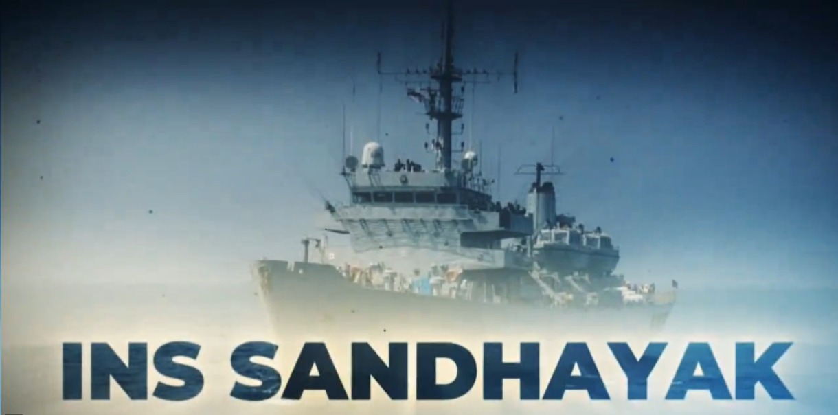
The Indian Navy on February 3 inducted its first of the four indigenously manufactured survey vessels, INS Sandhayak, amidst much fanfare. But in the jubilation, the yawning capability gap that India has vis-a-vis China was obscured.
Against China’s 60 survey vessels that have been aggressively mapping the Indian Ocean Region for unfettered submarine access, the Indian Navy has a lone INS Sandhayak to carry out hydrographic surveys.
INS Sandhayak is the first of four survey vessels manufactured in India with 80 percent indigenous content. The induction was attended by the Indian Defense Minister Rajnath Singh.
Sandhayak is the reincarnation of the Indian Navy’s hydrographic vessel that was de-commissioned in 2021 after four decades of service. Since then, till the induction of INS Sandhayak, the Indian Navy had zero research vessels.
Survey vessels are designed to examine subsea structures by sending sound waves into the ocean and collecting samples underwater. According to the database of the International Maritime Organization, there are 64 registered Chinese survey vessels built in or after 1990, surpassing 44 in the US and 23 in Japan.
The importance of research vessels cannot be overstated. The older INS Sandhayak had played a significant role in Operation Pawan in Sri Lanka in 1987. Operation Pawan was the code name of the Indian Peace Keeping Force’s (IPKF) mission to wrest control of Jaffna, the northern city of Sri Lanka, from the clutches of Tamil Tigers.
“China is aggressively pursuing the seabed mining doctrine and is much ahead of India. Also, in the South China Sea, underwater profiling is very advantageous for China for the operations of sub-surface vessels like AUVs. On the other hand, India requires more Survey vessels to have precise readings of Area of responsibility, and survey resources are usually over-stretched,” a Navy combat expert said.
In the case of littoral warfare, precise awareness of the regional waters is essential, especially for sea control. The warfare tactics for threat identification and countermeasures in the open oceans may vary from those in congested archipelagic waters. Also, to keep the marine supply lines open during hostilities, Naval escorts have to ensure that cargo reaches its destination without running aground or colliding in restricted waters.
The improvement in sea-bed mapping is essential, especially within the EEZ. Further, dispute settlement under the United Nations Convention on the Law of the Sea (LOSC) calls for precise survey reports so as to establish alleged violations of sovereign rights and maritime spaces. The hydrographical surveys can also assist in locating the seabed mines or detection of unexploded explosives in water.
#IndianNavy set to commission the #first ship of Survey Vessel Large Project #INSSandhayak on #03Feb 24, indigenously designed & constructed by @OfficialGRSE.
Best wishes to #Sandhayak & her crew on this grand occasion as they embark on a journey of #maritime excellence.… pic.twitter.com/ghM6ng3CPJ
— SpokespersonNavy (@indiannavy) February 1, 2024
During Operation Pawan, INS Sandhayak assisted the IPKF by providing crucial hydrographic data for planning amphibious landings, ensuring safe navigation, and supporting military operations. The vessel’s hydrographic surveys helped identify suitable landing sites and assess underwater obstacles.
Sandhayak is primarily designed for hydrographic surveys of ports, navigational channels, and Economic Exclusive Zones (EEZ). They also collect oceanographic data for military purposes. The vessel has a displacement of approximately 3,800 tons. It is 110 meters long, can cruise at a speed of 16 knots, and has a range of 6,500 nautical miles.
It is equipped with hydrographic sensors and state-of-the-art tools, including an Autonomous Underwater Vehicle (AUV), Remotely Operated Vehicle (ROV), and Multibeam Echosounder (MBES).
A retired Indian Navy submariner, however, told the EurAsian Times that the lack of numbers would not impede the force’s ability as it has a dedicated Naval Hydrographic Office in Dehradun. So far, India has been carrying out hydrographic surveys for friendly countries.
But “as India reaches out across the oceans, its requirement to carry out hydrographic survey are bound to increase,” the officer said. The Indian Navy now uses only Indian charts for navigation just like many other countries.
The nomenclature research vessel could be misleading as the oceanographic research conducted by these vessels yields invaluable data that can be used by the Chinese submarines seeking to navigate the shallow waters of Malacca Strait and through the East IOR.
Unsurprisingly, India raised alarm over the activities of the Chinese research vessels in the IOR under the pretext of conducting scientific tests. New Delhi registered a sharp protest with Sri Lanka, and the island nation, understanding India’s sensitivities, has put a one-year moratorium on the Chinese vessels from docking in its ports, beginning January 1.
Answering why China maintains a fleet of over 60 survey vessels, the retired Indian Navy submariner said: “That is a good question. Maybe they are doing more than just hydrographic surveys (‘research’ vessels) and are covering a much larger area, including the Northern passage.”
As reported by the EurAsian Times earlier, the last of the Chinese Oceanographic survey vessels coming into the region was Shi Yan 6, which came to dock in the Hambantota Port in Sri Lanka for three months in September 2023.
Called a “scientific research vessel,” Shi Yan 6 is manned by a crew of 60. It can carry out oceanography, marine geology, and marine ecology experiments. Besides gathering data on the sea bed and recording hydrological data to understand the undersea environment, the vessels can gather information about subsea cables and record telemetry data of missile firings.
Hence, the Chinese claim that its endeavors in the Indian Ocean are benign is not accepted by India. The capabilities that the Chinese Navy is pursuing in the region would help it undertake a military mission in the region.

Military Application Of Data
Besides the ostensible scientific goals, these surveys produce data on seabed conditions that serve both civilian and military purposes. While seismic data is critical in assessing geological conditions, the presence of hydrocarbons, water, and seabed conditions also affect the ability to detect submarines.
Research vessels involved in scientific research can also use their instruments for naval reconnaissance, gathering intelligence on foreign military facilities and vessels operating in the vicinity.
By studying seasonal deployment patterns in the region, China can optimize its submarine operations. Understanding maximum depths aids in visualizing mine warfare scenarios. Continual wind data collection informs take-off and landing requirements for both enemy jets and China’s airpower in the IOR.
Reports indicate that the Chinese have been particularly interested in the Ninetyeast Ridge, a mid-ocean ridge on the Indian Ocean floor. The ridge divides the Indian Ocean into the West and East Indian Ocean.
Naval experts have contended that this range is important for submarine operations. The data will aid Chinese submarines in increasing their activity in the Indian Ocean.
Experts also suggest that the Chinese survey activities near Indonesia and the Indian archipelago Andaman and Nicobar Islands aim to find the US Navy’s ‘fish-hook’ sensor networks. The network is designed to raise an alarm when a Chinese submarine enters the Indian Ocean.
This area is near critical Indian Ocean chokepoints like the straits of Sunda and Lombok, used by Chinese sub-surface warships to enter the Indian Ocean. Its shallow waters make the submarines prone to detection; hence, the need to know the region as the back of one’s hands.
In 2022, Yuan Wang 5, one of China’s latest generation space-tracking ships – used to monitor satellite, rocket, and intercontinental ballistic missile launches, docked at Sri Lanka’s southernmost port at Hambantota. The Pentagon has maintained that Yuan Wang ships are operated by the Strategic Support Force of the People’s Liberation Army.
In August 2019, a Chinese survey vessel ‘Shi Yan 1’ came 460 km east of the Indian island Port Blair in the Bay of Bengal and was forced to move out by the Indian Navy’s warships.
In December 2019, another of its survey vessels, Xiang Yang Hong 06, reportedly deployed at least 12 underwater gliders in the Indian Ocean. These long-endurance unmanned underwater vehicles (UUVs) traveled around 12,000 km at a depth of 6.5 km from the ocean surface to gather data on currents and water properties.
- Ritu Sharma has been a journalist for over a decade, writing on defense, foreign affairs, and nuclear technology.
- She can be reached at ritu.sharma (at) mail.com
- Follow EurAsian Times on Google News


